The coastal alluvium around the Mackay CBD sits on sandy clays and soft estuarine deposits, while the Pioneer Valley cuts into residual soils over metasedimentary bedrock. Each slope behaves differently. Monthly geotechnical slope monitoring tracks deformation across both profiles using inclinometers, piezometers, and surface survey points. Without this service, a slow creep in the clay-rich Paget district can go undetected until tension cracks appear. Complementing the monitoring with slope stability analysis helps quantify the factor of safety over time, while periodic standpipe piezometer readings verify pore pressure assumptions. The Mackay region receives over 1,600 mm of annual rainfall, so seasonal wetting cycles directly influence slope behaviour.
A 15 mm cumulative displacement over three monthly cycles in Mackay's wet season often precedes a full slope failure if left unmonitored.
Methodology and scope
A common error among local contractors is installing only surface markers without sub-surface instruments. Surface readings alone miss deep-seated slip surfaces. Monthly monitoring in Mackay must include inclinometer casings grouted into stable bedrock below the failure plane. The program follows AS 4678:2002 for earth-retaining structures and AS 1726:2017 for subsurface investigation. Typical parameters measured are horizontal displacement (mm/month), groundwater level (m), and crack width (mm). For slopes near the Goonyella rail corridor, we integrate differential settlement arrays to capture movement at transition zones. We also apply field vane shear tests on soft estuarine clays to validate undrained strength profiles used in the back-analysis.
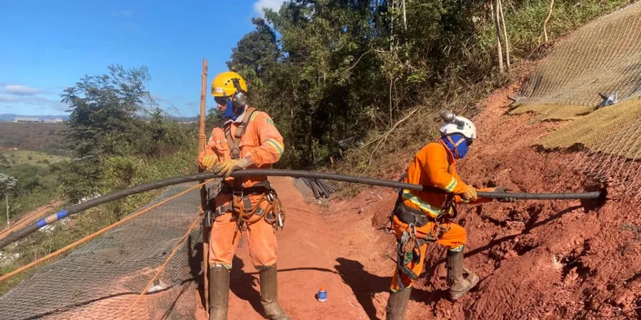
Technical reference image — Mackay
Local considerations
Mackay sits at an average elevation of only 11 metres above sea level. Heavy rain events from tropical cyclones can saturate slopes in hours. Monthly geotechnical slope monitoring picks up accelerating creep before it becomes a debris flow. The 2018 flooding event triggered multiple shallow slides along the Bruce Highway corridor. Without monthly readings, the transition from elastic to plastic deformation goes unnoticed. Early detection reduces the risk of road closures and structural damage. It also supports timely implementation of drainage improvements or buttress fills.
Manual or automated inclinometer readings at weekly or monthly intervals. Data is plotted against time and rainfall to identify acceleration trends. Reports include cumulative displacement profiles and trigger-level alerts.
02
Piezometric Monitoring and Drainage Assessment
Vibrating-wire piezometers or standpipes read monthly to track pore pressure response. Combined with surface drainage inspections, this service identifies critical saturation zones before they reduce effective stress.
Applicable standards
AS 4678:2002 — Earth-retaining structures, AS 1726:2017 — Geotechnical site investigations, AS/NZS 1170.2:2011 — Structural design actions (wind loading on slopes)
Frequently asked questions
What triggers a geotechnical slope monitoring program in Mackay?
Common triggers include recent slope instability, cut or fill works exceeding 5 m height, proximity to infrastructure, or regulatory requirements under AS 4678. Mining leases near the Goonyella system also mandate monthly monitoring.
How much does monthly slope monitoring cost in Mackay?
Typical costs range between AU$680 and AU$1,950 per month depending on the number of instruments, site access, and reporting frequency. A standard program with two inclinometers and three piezometers sits around AU$1,200 per month.
What instruments are used for deep-seated movement detection?
Inclinometer casings grouted into competent bedrock below the slip surface are the primary tool. They measure tilt at 500 mm intervals. For very slow movements, manual readings with a digital probe provide 0.1 mm precision.
Can monitoring detect failure before it happens?
Yes. Accelerating displacement rates over two or three consecutive monthly cycles indicate approaching failure. Combined with pore pressure data, the monitoring provides a 2- to 4-week lead time for remedial action in most Mackay soil conditions.
Is monthly monitoring sufficient for high-risk slopes?
For slopes classified as high risk under AS 4678, weekly or real-time monitoring is recommended. Monthly intervals suit moderate-risk sites where historical movement rates are below 1 mm per month and no rapid drawdown is expected.