Much of Mackay sits on deep alluvial deposits from the Pioneer River, with soft clays and loose sands extending over 20 metres in some areas. These conditions make road embankment design a serious engineering task. The high water table, often less than two metres below the surface, means any fill placed can trigger consolidation settlements that crack pavements or distort alignment. Before placing a single cubic metre of fill, the team runs a thorough site investigation that combines standard penetration testing with laboratory consolidation to predict how much and how fast the ground will settle. This upfront work prevents costly rework and keeps projects on schedule.
In Mackay's soft alluvial soils, embankment settlement can exceed 300 millimetres unless preload surcharges and wick drains are designed correctly from the start.
Methodology and scope
Mackay grew fast during the sugar boom of the early 20th century, and many of the original road corridors were built directly over floodplain soils without engineered fill. Today, those same corridors carry heavy mining and cane haulage traffic. Modern road embankment design in Mackay addresses this legacy by specifying staged construction sequences that allow pore pressures to dissipate before subsequent lifts are placed. The team also uses geotechnical instrumentation to monitor settlement plates and piezometers in real time. When embankments approach creek crossings or wetland buffers, a slope stability analysis confirms that the fill batter won't fail under saturated conditions. This is particularly relevant after a cyclone event, when the water table can rise abruptly and trigger shallow rotational slides.
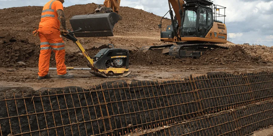
Technical reference image — Mackay
Local considerations
The most common issue the team sees in Mackay is differential settlement where an embankment transitions from a cut section onto deep fill. The excavator and compaction plant work the cut area first, but once the fill starts, the soft clay foundation squeezes sideways if loading happens too fast. The field crew monitors pore pressure with vibrating-wire piezometers installed at the fill base. If readings spike above 80% of the overburden stress, they halt placement and let the ground stabilise. This risk is especially high in the Bakers Creek and Sandy Creek corridors, where the subgrade is almost pure plastic clay.
Selected granular (DGB20) or rockfill; cohesive fills limited to < 5% fines
Maximum fill height
6 m (higher requires staged construction with surcharge)
Settlement tolerance
50 mm total, 25 mm differential over 20 m chord
Drainage layer thickness
300 mm granular blanket below embankment base
Slope ratio
1V:2H (standard); flatter 1V:3H near water bodies
Associated technical services
01
Subsurface Investigation & Soil Classification
Boreholes to 15 m depth with undisturbed tube sampling, SPT at 1.5 m intervals, and laboratory testing for Atterberg limits, particle size distribution, and compaction characteristics. This defines the foundation layering and identifies any soft zones that require ground improvement.
02
Embankment Stability & Settlement Analysis
Limit-equilibrium slope stability modelling using Bishop and Spencer methods, coupled with 1D consolidation analysis to predict primary and secondary settlement. Outputs include factor-of-safety contours and time-rate curves that guide construction sequencing.
03
Compaction Control & Quality Assurance
Field density testing using nuclear gauge and sand-cone methods, verified against modified Proctor curves. We also conduct proof-rolling with a 20-tonne roller to detect soft spots before the pavement layer is placed.
Applicable standards
AS 4678-2002 – Earth-retaining structures, AS 1726-2017 – Geotechnical site investigations, Austroads Guide to Pavement Technology Part 2: Pavement Structural Design, AS/NZS 1170.0-2002 – Structural design actions (general principles)
Frequently asked questions
How much does a road embankment design study cost in Mackay?
For a typical project, the cost ranges between AU$2,210 and AU$7,070 depending on embankment height, site access, and the number of boreholes required. A standard investigation with three boreholes to 10 m depth plus laboratory testing usually falls in the middle of that band.
What soil conditions are most challenging for embankments in Mackay?
The soft estuarine clays found near the Pioneer River mouth are the trickiest. They have undrained shear strengths below 20 kPa and high plasticity, meaning they compress slowly under load. Without wick drains or surcharging, settlement can continue for years after construction.
How long does a typical embankment design take from site investigation to final report?
A straightforward project with one or two boreholes and standard laboratory tests can be completed in four to six weeks. If staged construction or ground improvement is needed, the design phase may extend to eight weeks to allow for settlement monitoring and re-analysis.
Do I need a geotechnical report for a small access road embankment?
Yes, even a low embankment (< 2 m) on Mackay's alluvial soils can settle unevenly if the foundation isn't characterised. A targeted investigation with a single borehole and basic consolidation testing costs a fraction of what a pavement failure would cost to repair later.